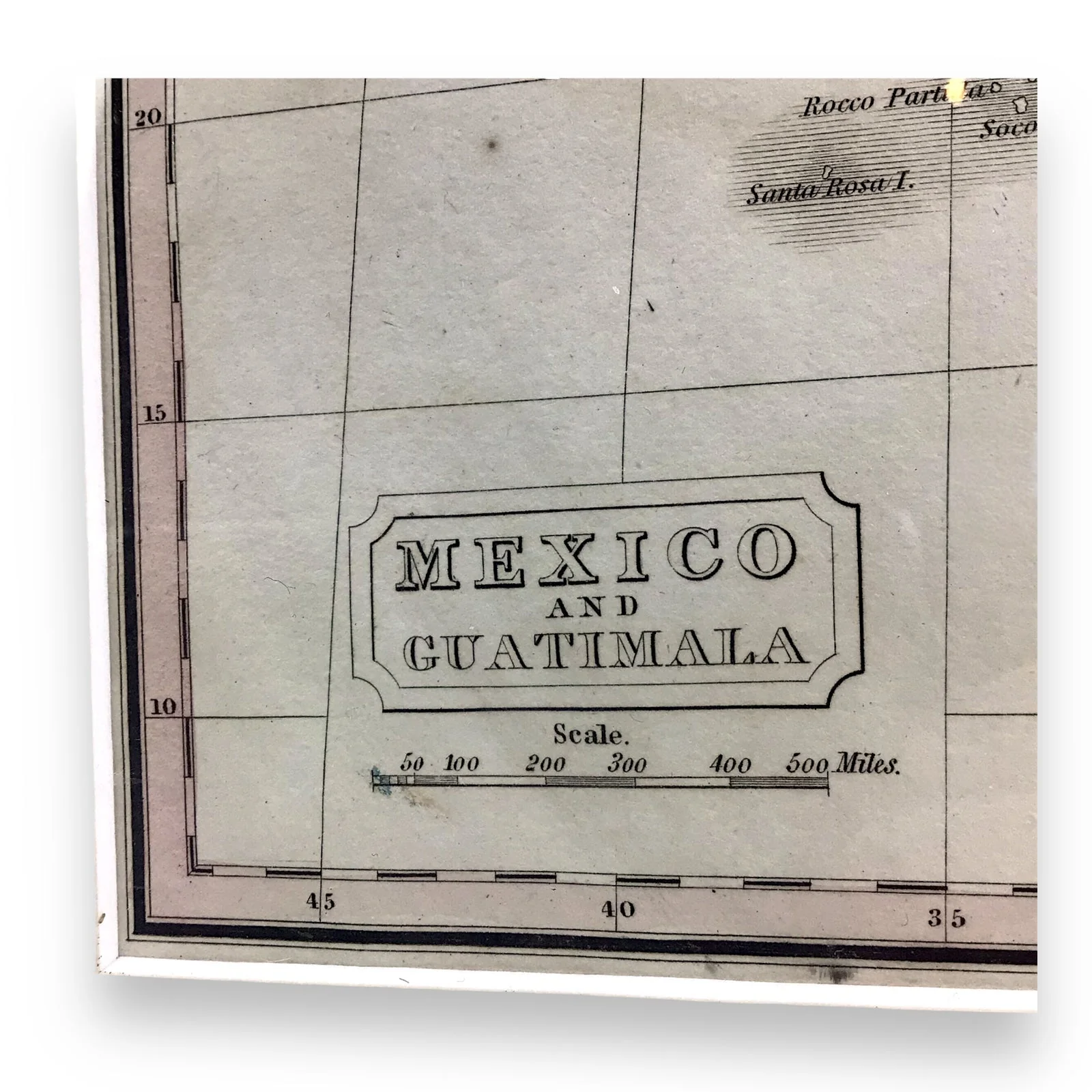


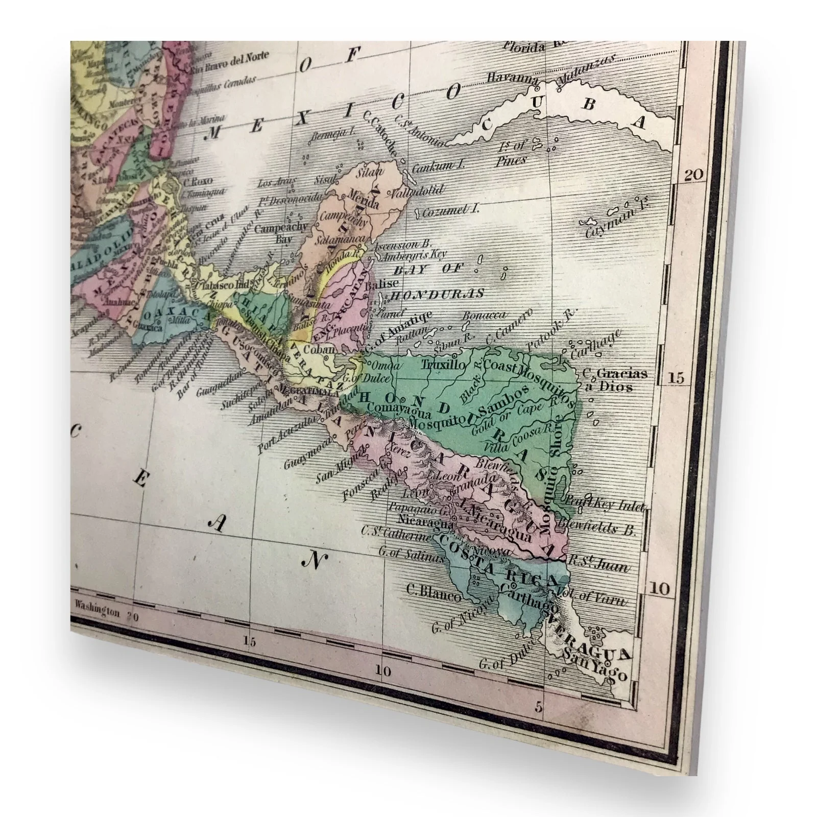
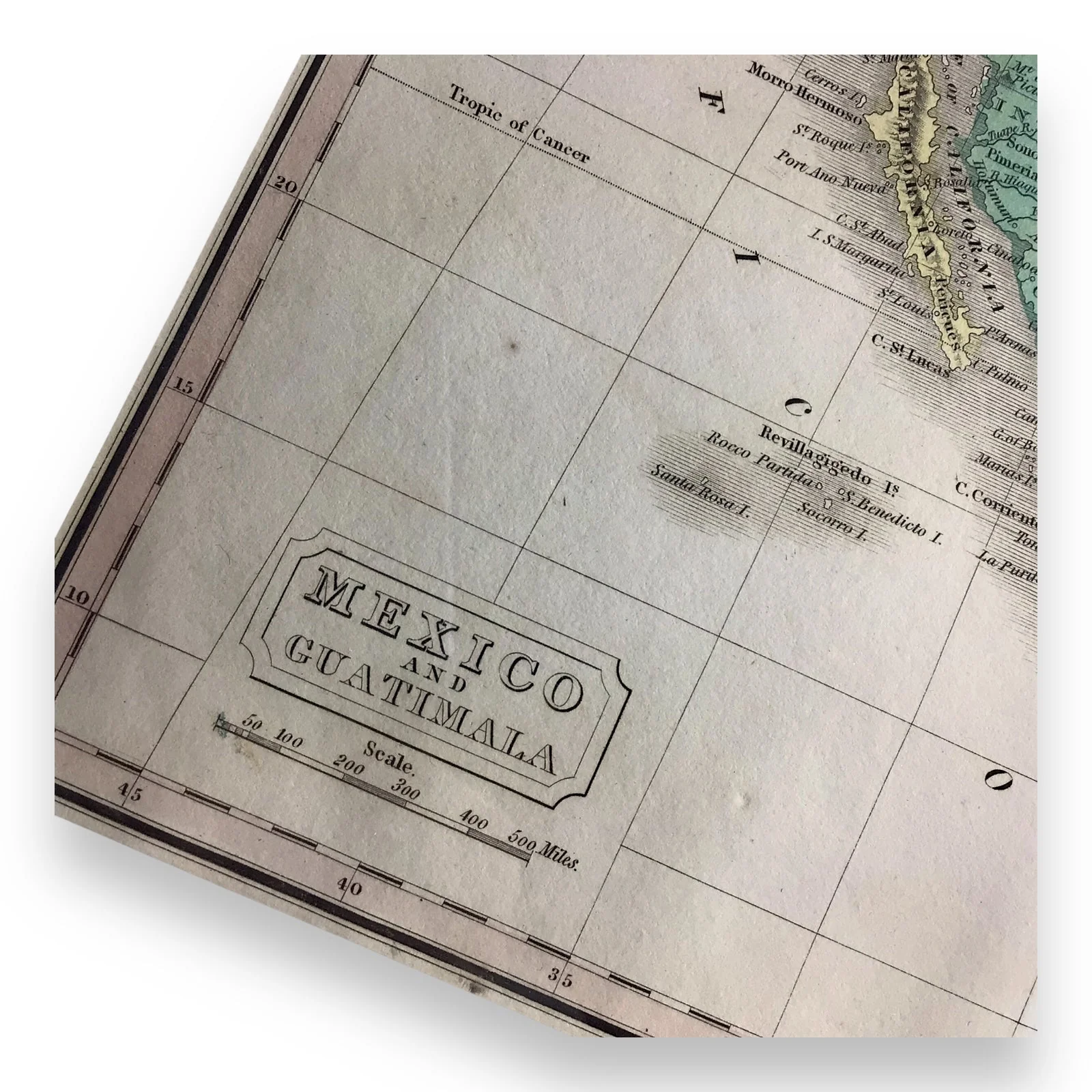


Rare Texas Independence Map "Mexico and Guatimala," c. 1832 – Framed
This Antique Map titled "Mexico and Guatimala", was printed around 1832, just three years before the Texas War of Independence. This map is a cartographical piece of history, showcasing Mexico's territorial extent into what is now the Southwest United States and California. Notably, Texas is depicted as part of Mexico, labeled as "Texas or New Estremadura", highlighting the region's political landscape prior to the Texas Revolution. Drawn and engraved by Alexander Findlay, a well-known cartographer of the era
This significant map provides a glimpse into the shifting borders of North America just before the dramatic events that would lead to Texas' independence and its eventual incorporation into the United States of America.
The map includes several other historical regions, including parts of Sonora, marked as "New St. Andero" and other locations of interest from the period. This map was taken from the 1835 publication by Thomas Kelly in London, for the "A New and Universal English Dictionary" by Rev. James Barclay, with maps drawn and engraved by Alexander Findlay.
Key Features:
- Depicts Texas as part of Mexico, labeled as "TEXAS OR NEW ESTREMADURA"
- Includes areas of Sonora, New St. Andero, and other designations relevant to the geopolitical layout of the time
- From the c.1835 publication of "A New and Universal English Dictionary" by the Rev. James Barclay, published in London by Thomas Kelly
- Drawn and engraved by Alexander Findlay, a well-known cartographer of the era
Condition: This antique map remains in great condition, with no visible tears, rips, or folds. It has been well-preserved within its frame, ensuring the integrity of the aging paper and the vibrant color. The colors remain rich, vivid, and finely detailed.
Item Dimensions
- Map Size: 9.75" W x 8" H
- Framed Size: 12.65" W x 11" H
Location: Collectors Crossroads - QM0092
Original: $696,300.00
-70%$696,300.00
$208,890.00Product Information
Product Information
Shipping & Returns
Shipping & Returns
Description
This Antique Map titled "Mexico and Guatimala", was printed around 1832, just three years before the Texas War of Independence. This map is a cartographical piece of history, showcasing Mexico's territorial extent into what is now the Southwest United States and California. Notably, Texas is depicted as part of Mexico, labeled as "Texas or New Estremadura", highlighting the region's political landscape prior to the Texas Revolution. Drawn and engraved by Alexander Findlay, a well-known cartographer of the era
This significant map provides a glimpse into the shifting borders of North America just before the dramatic events that would lead to Texas' independence and its eventual incorporation into the United States of America.
The map includes several other historical regions, including parts of Sonora, marked as "New St. Andero" and other locations of interest from the period. This map was taken from the 1835 publication by Thomas Kelly in London, for the "A New and Universal English Dictionary" by Rev. James Barclay, with maps drawn and engraved by Alexander Findlay.
Key Features:
- Depicts Texas as part of Mexico, labeled as "TEXAS OR NEW ESTREMADURA"
- Includes areas of Sonora, New St. Andero, and other designations relevant to the geopolitical layout of the time
- From the c.1835 publication of "A New and Universal English Dictionary" by the Rev. James Barclay, published in London by Thomas Kelly
- Drawn and engraved by Alexander Findlay, a well-known cartographer of the era
Condition: This antique map remains in great condition, with no visible tears, rips, or folds. It has been well-preserved within its frame, ensuring the integrity of the aging paper and the vibrant color. The colors remain rich, vivid, and finely detailed.
Item Dimensions
- Map Size: 9.75" W x 8" H
- Framed Size: 12.65" W x 11" H
Location: Collectors Crossroads - QM0092